Pffft Member Username: Pffft Post Number: 928 Registered: 12-2003 Posted From: 69.221.93.11 |
Since all questions come to be answered here, can anyone tell me about this project, which was supposedly torn down in the late '40s? A former resident who was a child then told me it was called the Dequindre projects. True? Also heard that a Vlasic pickle plant was built there, but I can't find mention of any other Vlasic plant but the one in Imlay City. | ||
Mikem Member Username: Mikem Post Number: 2536 Registered: 10-2003 Posted From: 208.54.94.33 |
I'm on the road, but I saved an aerial photo of the complex on my home computer. Maybe Hornwrecker can post it here if he goes to the '49 CULMA photos and searches the area. IIRC, they were wedged between 6 & Davison, east of Dequinder. I've been meaning to ask if anyone had more information about them. Not sure if they were built for war workers, or an earlier public housing project. | ||
Pffft Member Username: Pffft Post Number: 931 Registered: 12-2003 Posted From: 69.221.93.11 |
Wow, great Mikem ...I know several African-American families who lived there in the mid-'40s. There were "sides" ...you were on the east side or the west side of the project. Not sure why it was demolished...the demo might have been in the very early '50s, if it was still there in '49. | ||
Royaloakian Member Username: Royaloakian Post Number: 70 Registered: 05-2004 Posted From: 205.188.116.137 |
The Vlassic pickle plant building is still there. It is on the west side of Dequindre just south of Six Mile and the rr tracks. It still has some of the greentrim on the building. | ||
Pffft Member Username: Pffft Post Number: 932 Registered: 12-2003 Posted From: 69.221.93.11 |
Thanks, Royaloakian, I'll drive by and look. Is it abandoned? | ||
Hornwrecker Member Username: Hornwrecker Post Number: 1196 Registered: 04-2005 Posted From: 63.41.8.251 |
I'll look at the 1949 aerial and see if I can find it, and post the results this evening. War time housing was only meant for the duration of the war, although there are still a few examples standing, much like the temporary barracks on some bases being used 60 years later. There was also temp housing down McNichols, and Davison to Van Dyke. There must have been enough large tracts of vacant land there at that time. | ||
Pffft Member Username: Pffft Post Number: 937 Registered: 12-2003 Posted From: 69.221.93.11 |
Thanks, HW... Maybe putting non-military folks into projects like this was meant to relieve some of the problems caused by an exploding population of people coming here to work, and no place to live, especially if they were African-American. | ||
Royaloakian Member Username: Royaloakian Post Number: 71 Registered: 05-2004 Posted From: 64.12.116.204 |
Pfft I can't really recall if it is or isn't, it has a brown/reddish brick front | ||
Mikem Member Username: Mikem Post Number: 2537 Registered: 10-2003 Posted From: 208.54.94.97 |
Here is a link to the low resolution aerial photo showing the complex, south of 6 Mile, north of the dark rectangle that is the HP water reservoir. Best I can do on my shoe-phone: http://www.culma.wayne.edu/aer ial_photos/wayne/1949/ha-4-75. pdf | ||
Pffft Member Username: Pffft Post Number: 938 Registered: 12-2003 Posted From: 69.221.93.11 |
Cool ...so it looks like Dequindre was indeed a dividing line between the west side of the war housing/project and the east side of it. | ||
Hornwrecker Member Username: Hornwrecker Post Number: 1197 Registered: 04-2005 Posted From: 63.41.8.180 |
1949 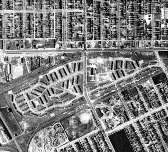 1956 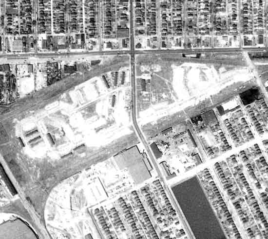 1961 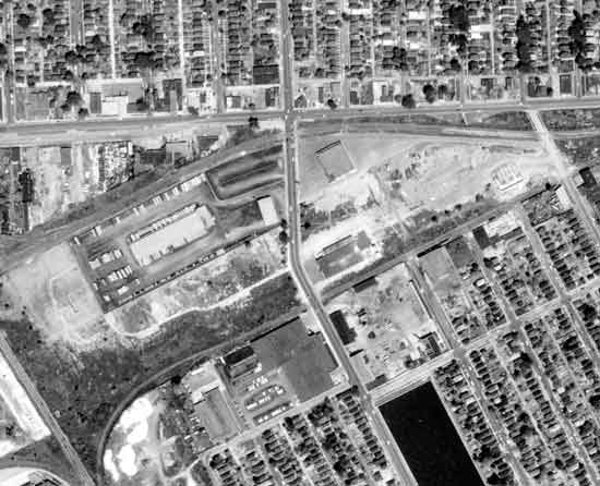 | ||
Livedog2 Member Username: Livedog2 Post Number: 294 Registered: 03-2006 Posted From: 24.223.133.177 |
I remember the housing project down McNichols, and Davison to Van Dyke. I don't remember the name of it but I remember it in the late 1940's and early 1950's. There was also a housing project near Buffalo and Charles Sts. near White School. Those projects were called the Charles Projects if I remember correctly. It was just Southeast of Jayne Field and Lasky Park. I have often wondered who the Lasky Park was named after. There was also a housing project on the near Westside but I can’t remember the name of it to save my life. I should remember it because my uncle, my namesake, lived there and we use to visit there all the time. I want to say it was ________ Garden! There were also a housing project, I want to say on Outer Drive but maybe it was the ones on McNichols that were made out of blocks a much more permanent dwellings. I can remember after WWII people hoped they could buy one of these homes from the government. I’ll have to try to get in touch with my cousin whose father lived in the housing project on the near Westside. Then there was a housing project over on 8 Mile and Wyoming. I think it was called Oakvalle or something like that. THere was also a housing project in what was called Conant Gardens up near Conant and Nevada Sts. Livedog2 got the wheels rolling but having trouble remembering all the details... | ||
Pffft Member Username: Pffft Post Number: 940 Registered: 12-2003 Posted From: 69.221.93.11 |
Hornwrecker -- fantastic. It looks like the structures of the projects were still there in 1949, most of the buildings gone by '56, and in '61 you can see what must be the Vlasic plant on site, on the west side of Dequindre... Livedog2, I've heard of the Buffalo Homes, that may be the project on Buffalo you mean? It's interesting which of these started out as war housing ... I wondered about Lasky too. The Lasky Theater was just down on Joseph Campau, a lot of kids from the neighborhood would go there to the show. It's now Lasky Furniture. Just around the corner from these "Dequindre projects" as one resident told me they were called, is John DeLorean's boyhood home on Marx, which was near the corner of Six Mile. | ||
Pffft Member Username: Pffft Post Number: 941 Registered: 12-2003 Posted From: 69.221.93.11 |
The "Dequindre project" sprawled on both sides of Dequindre, as this guy told me, and you can see that it does on the map... | ||
Hornwrecker Member Username: Hornwrecker Post Number: 1199 Registered: 04-2005 Posted From: 63.41.8.180 |
I found it interesting that in the 1961 photo you can still see traces of the roads in the southwest part below the pickle plant. The 1952 photo showed all of it still standing, so I didn't post it, and only 11 structures remain in the 1956 aerial. I ran into a feature awhile ago, that looked like an oval race track (Indy) on one photo, researching something else. Looking back to earlier photos, it was temporary housing for war workers. IIRC it was around Davison and Sherwood. | ||
Livedog2 Member Username: Livedog2 Post Number: 296 Registered: 03-2006 Posted From: 24.223.133.177 |
I'd forgotten all about that Pffft. You are so right about John DeLorean's boyhood home. Why in the world did he resort to dealing with drugs to finance his car? This stupidity on his part has besmirched his own name. Prior to that he was considered such a genius in the automobile industry and now, he’s just another smuck! Where was his auto plant located? I wonder if it’s on the “Old Car Factories” thread. Livedog2  | ||
Kilgore_south Member Username: Kilgore_south Post Number: 54 Registered: 05-2005 Posted From: 24.176.20.117 |
Must be the same pickle factory where this happened last year: Dog Drags Human Leg From Abandoned Factory | ||
Pffft Member Username: Pffft Post Number: 942 Registered: 12-2003 Posted From: 69.221.93.11 |
Yikes...that abandoned pickle plant is on Riopelle, a good way south of this site where the Vlasic plant was (is?). How many abandoned pickle plants could there be in Detroit? | ||
Pffft Member Username: Pffft Post Number: 943 Registered: 12-2003 Posted From: 69.221.93.11 |
Livedog, Despite all that, Delorean was an amazing guy. I met the guy who owns the funeral home where John was laid up; he gave me one of his funeral cards, which I'm glad to have. It was the funeral home on Woodward in Royal Oak...they had seven or more Deloreans parked outside during his viewing and service, it was very impressive. Do you suppose the people who live in the house on Marx know that it was Delorean's boyhood home? Wikipedia has the exact address and everything... | ||
Kilgore_south Member Username: Kilgore_south Post Number: 55 Registered: 05-2005 Posted From: 24.176.20.117 |
Isn't Riopelle one of the side streets just south of the plant, a couple blocks west of Dequindre? I'll have to check a map and see... You'd think the article would have said the plant was at Dequindre/McNichols though. | ||
Livedog2 Member Username: Livedog2 Post Number: 297 Registered: 03-2006 Posted From: 24.223.133.177 |
It would be nice to see a photo of John DeLorean's boyhood home. What a great memento to have a funeral card of DeLorean! Is the funeral home a Desmond Funeral Home, Pffft? Livedog2 | ||
Pffft Member Username: Pffft Post Number: 944 Registered: 12-2003 Posted From: 69.221.93.11 |
Yeah if you look at the map, the Vlasic plant is right up at the southwest corner of Six/McNichols and Dequindre, while Riopelle is well below Dequindre. Unless the cops or TV reporters misidentified the street... | ||
Pffft Member Username: Pffft Post Number: 945 Registered: 12-2003 Posted From: 69.221.93.11 |
Livedog, Yes, he was laid out at Desmond. Some folks were surprised the funeral was here, and burial. He was a Detroit guy in the end...the Delorean home is in the 17 thousand block of Marx, near the corner of Six Mile and Dequindre. | ||
Kilgore_south Member Username: Kilgore_south Post Number: 56 Registered: 05-2005 Posted From: 24.176.20.117 |
Pffft - here's a link to the Google map of the area: http://maps.google.com/maps?f= q&hl=en&q=Dequindre+St+%26+E+M cNichols+Rd,+Hamtramck,+MI+482 12&om=1&ll=42.418546,-83.08346 3&spn=0.014922,0.043259 Notice that Riopelle is is 3 blocks west of Dequindre, and it also continues south of the megablock that the factory is on. Still it's a side street, so why would they use it to identify the location? Which brings us to your original question: If this isn't our pickle factory, how many abandoned pickle plants can there be in the D?? My brain hurts, time for bed.  | ||
Livedog2 Member Username: Livedog2 Post Number: 298 Registered: 03-2006 Posted From: 24.223.133.177 |
I played hockey with Larry Desmond after he left Harvard in I think it was 1974. Delorean was a genius with bad jusgement: http://www.findagrave.com/cgi- bin/fg.cgi?page=gr&GRid=106452 02 REPOSE EN PAIX! Livedog2 | ||
Pffft Member Username: Pffft Post Number: 947 Registered: 12-2003 Posted From: 69.221.93.11 |
Ah, it might have been Larry who gave it to me. I tried to upload the funeral card, I'll try again tomorrow. The quote on the back is from Dylan Thomas: "Do not go gentle into that good night, Rage, rage against the dying of the light." There should be an automotive bus tour of Detroit and it should definitely run over to Six and Dequindre, down Marx Street... (Message edited by pffft on May 23, 2006) | ||
Livedog2 Member Username: Livedog2 Post Number: 299 Registered: 03-2006 Posted From: 24.223.133.177 |
Pffft, I think that is a great idea for a tour business in Detroit. It could be called The Bus Tour of the Automotive Industry That No Longer Exists! One time I went to Chicago and they had a Gangster Tour of all the famous locations where gangster activity took place. Places like the site of the Valentine's Day Massacre, Biograph Movie Theatre, Al Capone's Grave, etc. They did a land office business with people scheduled every few hours leaving the heart of downtown on packed buses with eager tourists. Hollywood had a great Graveline Tour of the cemeteries where the famous and infamous were buried. They conducted them in old Hearses converted to stretch style to accommodate more tourists. Livedog2 | ||
Pffft Member Username: Pffft Post Number: 948 Registered: 12-2003 Posted From: 69.221.93.11 |
Oh, don't get me started. You could have a great Purple Gang tour here as well... Heck, look at the pickle history we've unearthed, barely. The Vlasic business started in Detroit in the eastern market area, they had a dairy route and added Polish pickles, then later put them in bottles... | ||
220hendrie1910 Member Username: 220hendrie1910 Post Number: 23 Registered: 02-2006 Posted From: 20.137.2.50 |
This dog-with-woman's leg stuff is too ghastly, so let me clear the Vlasic factory on this: If you follow the link that Kilgore_south gave (here), then click on the link to the original story of February 17, you'll see that the body was found "in an abandoned building near St. Aubin and Farnsworth on Detroit's east side". Pickled in Ottawa. | ||
Livedog2 Member Username: Livedog2 Post Number: 300 Registered: 03-2006 Posted From: 24.223.133.177 |
Good detective work, 220hendrie1910! Livedog2 | ||
Mikem Member Username: Mikem Post Number: 2538 Registered: 10-2003 Posted From: 68.43.15.105 |
I've searched my directories and a few other references, but I find no mention of a Dequindre housing project, which makes me believe it was short-lived or all black. Just south of the housing project looks to be the remains of Dequindre Park, brief home of the Detroit Stars Negro League baseball team: 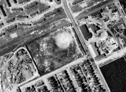 And the single season, semi-pro Detroit Wolves: 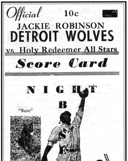 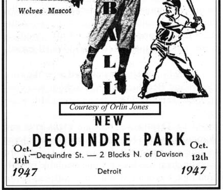 Meanwhile, Zack (machine operator) & Catherine DeLorean 17199 Marx...the only DeLoreans in the city. Vlasic Food Co., 14255 Dequnidre. | ||
Livedog2 Member Username: Livedog2 Post Number: 303 Registered: 03-2006 Posted From: 24.223.133.177 |
Mikem that's another home run of information! :-) Livedog2 | ||
Pffft Member Username: Pffft Post Number: 954 Registered: 12-2003 Posted From: 69.221.93.11 |
Mikem... Very cool Dequindre Park card...yeah, I heard it was close to the project. I guess it's possible the project wasn't one per se, but meant for auto workers who in this case happened to be black? I'm curious why you say the project must have been short-lived and/or occupied by all blacks (and I think that was the case) if it wasn't mentioned in the references you have. It couldn't have been too short-lived, I know people who lived there from '44-'45 until it was demoed, which would be in around '53 or '54 it sounds like. And yeah, that's the Delorean residence, literally walking distance from the Dequindre project. The houses on Marx all seem to be original, and there's a shuttered old bar building on the corner. There's a megachurch being built on the west side of Dequindre, on the old project site. On the east side, a US Postal Service building sits. There's a KFC right at the corner of Six Mile/Dequindre. Just south of the east side project site, you can still see the Highland Park reservoir, with barbed wire and fence around it. I wonder if it's still used? A former Dequindre resident told me he'd seen the Vlasic building, with green trim still on it, not long ago, so I wonder if it was recently demo'ed for the megachurch construction? This is fascinating, many thanks... | ||
Mikem Member Username: Mikem Post Number: 2539 Registered: 10-2003 Posted From: 68.43.15.105 |
I say short-lived because I didn't think the city went into the project building business until late in the depression or later (i.e. Sojourner Truth, 1943), and this complex was being demolished by the early 1950's, while others from that era are still around. All black because who cared enough about them to list their project in any kind of directory, right? However, I'm inclined to believe that they were built after 1940, and that maybe the more probable reason that they don't show in my directories. Nothing in my 1935 or 1940 directories indicates any sort of housing project in many of the areas where they were located, leading me to believe that they were built during the war for defense workers, or that they were built as part of slum cleareance projects for blacks. I don't have directories for the following decades to check. Of course whites wanted public housing too, especially if it was all white, and many battles were fought over where and for whom the public housing would be built. Livedog mentioned the Charles projects. This 1949 photo shows the area south of Charles, from Mt Elliott on the east, to just west of Buffalo on the west, with projects on either side of Buffalo, along the east side of Mound, and in the southeast corner along Caniff/Mt Elliott Ct: 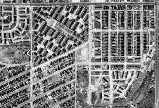 More recent view, with most of it gone, but some still there at Mound & Charles: 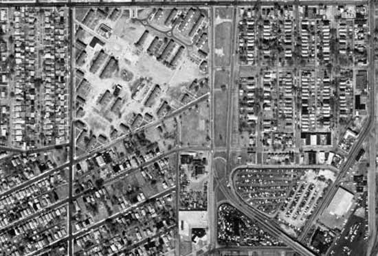 | ||
Pffft Member Username: Pffft Post Number: 961 Registered: 12-2003 Posted From: 69.221.93.11 |
Yeah Mikem, I agree, I'd bet the Dequindre project was built during the war. How was it these aerial shots were taken, and for what purpose? | ||
Mikem Member Username: Mikem Post Number: 2540 Registered: 10-2003 Posted From: 68.43.15.105 |
They are from a collection of aerial survey photos of the metro area at WSU, donated by Detroit Edison. They were used for transmission line planning purposes. http://www.culma.wayne.edu/aer ial_photos/ | ||
Livedog2 Member Username: Livedog2 Post Number: 304 Registered: 03-2006 Posted From: 24.223.133.177 |
Mikem was there a "projects" as in housing project called Marvin or Andersen Gardens or something similar to that on the near Westside? I might be mixing that up with the Monopoly game property but it's something like that. Livedog2 | ||
Hamtramck_steve Member Username: Hamtramck_steve Post Number: 2963 Registered: 10-2003 Posted From: 68.73.198.135 |
I always wondered how it came to be that those 1950's houses were built in the middle of 1920's Detroit. I always wondered, but never enough to ask. There's even less of the Charles Street projects left than shown in that more recent photo. Under Archer, 95% was demolished. The remaining units were renovated and enlarged. New buildings were supposed to replace the demo'd ones, but they never got that far. They cleared the land and erected a chainlink fence. | ||
Pffft Member Username: Pffft Post Number: 963 Registered: 12-2003 Posted From: 69.221.93.11 |
What 1950s houses? | ||
Livedog2 Member Username: Livedog2 Post Number: 305 Registered: 03-2006 Posted From: 24.223.133.177 |
Huh? "1950's houses were built in the middle of 1920's Detroit." I'm cornfused! Livedog2 | ||
Mikem Member Username: Mikem Post Number: 2541 Registered: 10-2003 Posted From: 68.43.15.105 |
Detroit: A Manual for Citizens | ||
Mikem Member Username: Mikem Post Number: 2542 Registered: 10-2003 Posted From: 68.43.15.105 |
I think Steve is referring to the homes in the top left corner of the last picture I posted, where there previously had been public housing. The public housing had been replaced with new construction circa 1950s, while the surrounding areas were filled with older homes, such that there appeared to be a plot of 1950s suburbia not at the far edge of the city, but in the middle of an older, established neighborhood. | ||
Livedog2 Member Username: Livedog2 Post Number: 306 Registered: 03-2006 Posted From: 24.223.133.177 |
Herman Gardens! Thank you, Mikem! That's the one I was trying to think of that we use to go visiting my aunt and uncle at in the 1950's. Where exactly were the Herman Gardens located. What I mean is what streets bounded it? Livedog2 remembering... | ||
Mikem Member Username: Mikem Post Number: 2543 Registered: 10-2003 Posted From: 68.43.15.105 |
There were a variety of styles of "defense housing", but I think the long, narrow, dark-colored housing in the aerial pictures are Quonset huts such as these, found in the Virtual Motor City archives labeled as "Defense Housing, Detroit:" 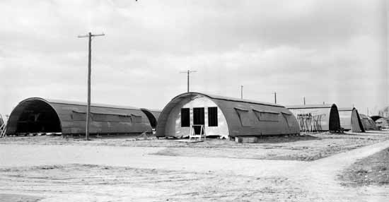 | ||
Mikem Member Username: Mikem Post Number: 2544 Registered: 10-2003 Posted From: 68.43.15.105 |
NE corner of Southfield & Tireman https://www.detroityes.com/webisode s/2004/13-UrbanPrairie/HermanG arden.htm https://www.atdetroit.net/forum/mes sages/50492/55001.html | ||
Livedog2 Member Username: Livedog2 Post Number: 308 Registered: 03-2006 Posted From: 24.223.133.177 |
Neat map that changes back and forth from 1967 to 2003, Mikem! Livedog2 | ||
Pffft Member Username: Pffft Post Number: 964 Registered: 12-2003 Posted From: 69.221.93.11 |
Hmm, from the description I've gotten from a resident, I don't think the Dequindre buildings were Quonset huts, I think he would have said so...that would have made quite an impression on a kid, which he was in the '40s. These were non-service personnel living in the buildings from '44 until '53 or '54 too... Re the '50s houses, gotcha. The projects we were talking about all dated earlier. Those houses north of Six Mile on Marx etc. look every bit of their 90 or so years... | ||
Livedog2 Member Username: Livedog2 Post Number: 309 Registered: 03-2006 Posted From: 24.223.133.177 |
I remember my father telling me that the Highland Park/Hamtramck/Detroit Reservoir, whatever it is called, there on Dequindre and Davison had National Guard soldiers guarding it during WWII. He said the same thing applied with the Detroit/Windsor Tunnel that there were soldiers inside the tunnel guarding it. Does anyone know if the Reservoir is still in use. I would imagine it still is in operation. Livedog2 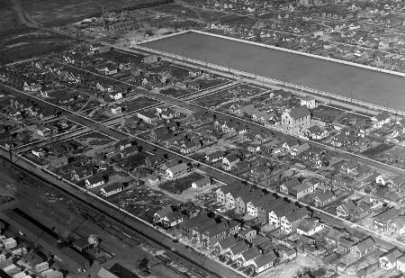 Livedog2 | ||
Mikem Member Username: Mikem Post Number: 2545 Registered: 10-2003 Posted From: 68.43.15.105 |
That's true; guards were posted at Water Works Park and Springwells Pumping as well. The HP reservoir is still in use. | ||
Toolbox Member Username: Toolbox Post Number: 914 Registered: 10-2003 Posted From: 69.14.125.129 |
Yes it is still in use. It is part of HP's water system. When my uncle's were HP firefighters they would fish in it for dinner back at the hall. | ||
Pffft Member Username: Pffft Post Number: 965 Registered: 12-2003 Posted From: 69.221.93.11 |
Fish in it??? What kind of fish are in there? The guy I know said as boys they would swim in the reservoir, in the '40s. I don't see how they got in if the same barbed wire fence was in play... | ||
Pffft Member Username: Pffft Post Number: 966 Registered: 12-2003 Posted From: 69.221.93.11 |
p.s. you'd think in the early '50s anyway when they ran out of room to build houses in Detroit, a reservoir wouldn't be a good use for so much land in the city...yet there it is. It's huge! | ||
Livedog2 Member Username: Livedog2 Post Number: 310 Registered: 03-2006 Posted From: 24.223.133.177 |
I remember people fishing and swimming in it in the late 1940's and early 1950's when I was a kid. I never did figure out how the fish got in there but I just figured G-d put them in there! +<(:-)~ Livedog2 | ||
Livedog2 Member Username: Livedog2 Post Number: 311 Registered: 03-2006 Posted From: 24.223.133.177 |
The next question I'm going to pose is what information is there about a place we use to call "Green Hills" when I was a kid. It is where the prison is located over there off of Conant and Jerome Sts. Spac time or for you Americans it's sleep time! Livedog2 | ||
Mikem Member Username: Mikem Post Number: 2546 Registered: 10-2003 Posted From: 68.43.15.105 |
http://hpfolks.com/articles_2004/HPF_articles_2004/got_water_2004/index.html 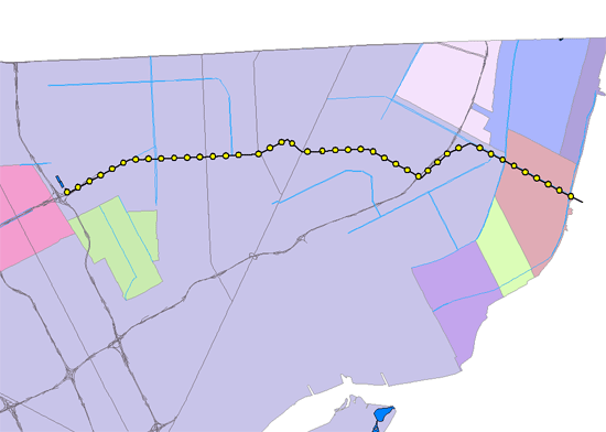 HP runs a 30" pipeline from a pumping station in Grosse Pointe Farms up Moross to Chester to Harper to Whittier to Houston, where at the corner of Filbert sits this unremarkable little building, another piece of HP surrounded by Detroit, where it gets a boost for the rest of its trip across Gratioit to McNichols to Davison to the reservoir. 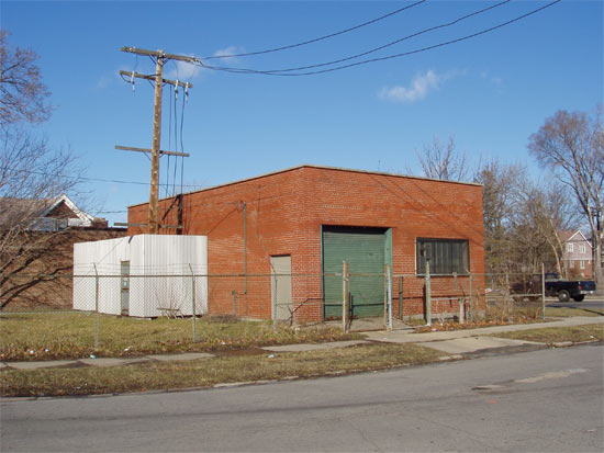 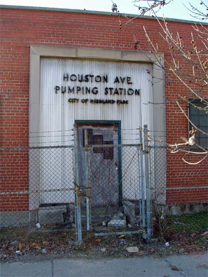 | ||
Mikem Member Username: Mikem Post Number: 2547 Registered: 10-2003 Posted From: 68.43.15.105 |
I found this photo in the Motor City archives mis-labeled as Parkside housing, but it's really the Charles Terrace project at Mound (before it was a divided road) & Charles, looking southwest: 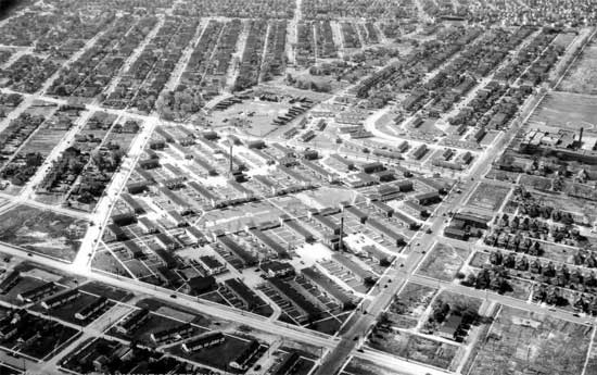 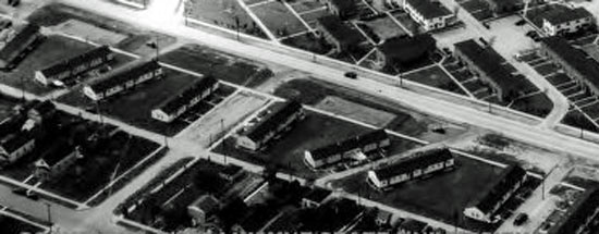 Zooming in, what I thought could be Quonset huts are really single story, wood frame defense housing of this sort, labeled as Oakdale Housing (must be west side?): 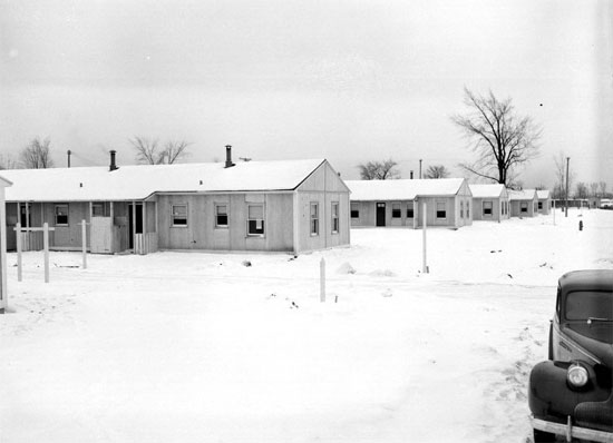 | ||
Mikem Member Username: Mikem Post Number: 2548 Registered: 10-2003 Posted From: 68.43.15.105 |
While the more permanent housing in the center of the Charles Terrace was/is probably brick, such as these Parkside Homes, Conner at E Warren: 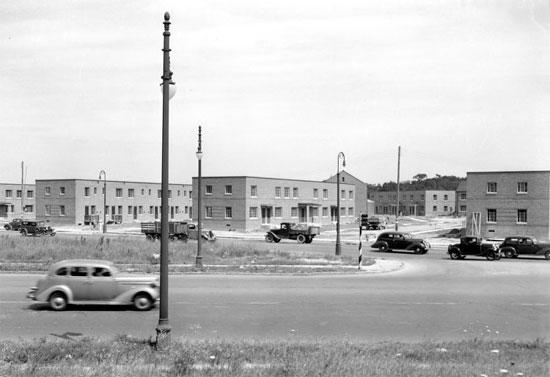 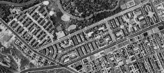 Just down the raod at Mack & Conner is more housing of the temporary nature: 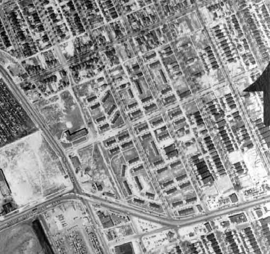 ANd the west side of Connor was lined for over a mile with Quonset huts: 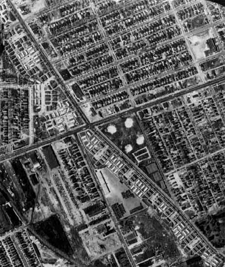 I see Quonsets all over the city, usually in industrial areas, in various conditions, and I've wondered if these were all surplus housing that was possibly auctioned off at the end of the war? 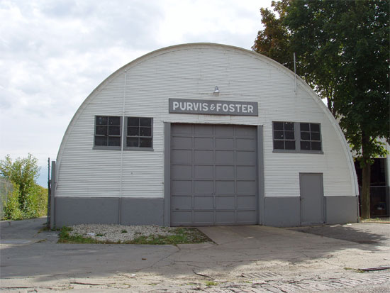 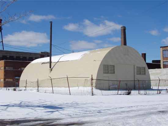 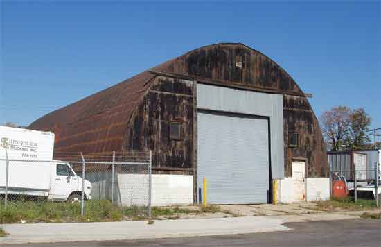 | ||
Pffft Member Username: Pffft Post Number: 967 Registered: 12-2003 Posted From: 70.141.77.196 |
Uh, Mike already explained it. But thanks. | ||
Pffft Member Username: Pffft Post Number: 972 Registered: 12-2003 Posted From: 70.141.77.196 |
Hmm, We were having a nice conversation here. Hope it continues in that spirit. | ||
Hornwrecker Member Username: Hornwrecker Post Number: 1203 Registered: 04-2005 Posted From: 63.41.8.160 |
Here's a series of photos from the McNichols/Sherwood/Davison area. NYC tracks far left, McNichols on the bottom, GTW tracks bottom right corner. 1949 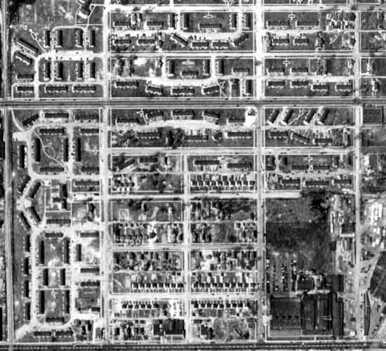 1956 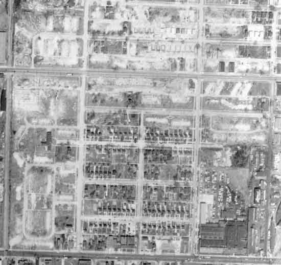 1961 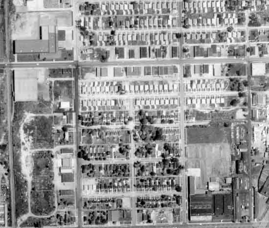 I was looking on the 1961 map for Silverstein's surplus place, and noticed what appeared to be a strange looking race track, looking back further it turned out to be temp wartime housing. | ||
Mikem Member Username: Mikem Post Number: 2550 Registered: 10-2003 Posted From: 68.43.15.105 |
I was just going to post a photo of that area. I've found more temporary housing on the east side: 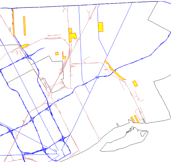 Such as these homes on the north side of Nevada, just west of the Lutheran School for the Deaf: 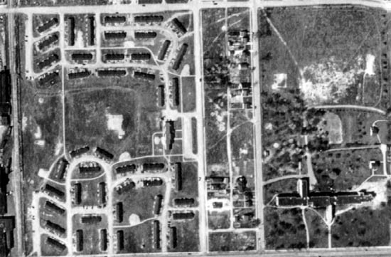 This strip along Dequindre, from State Fair down to Nevada: 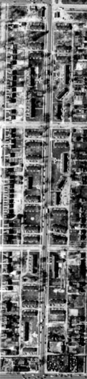 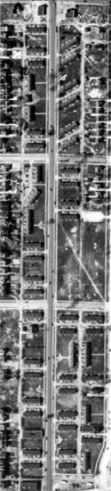 This strip along Oakland (I-75) from Eight Mile down to Nevada: 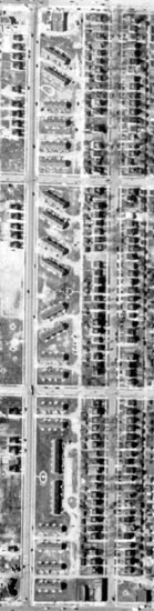 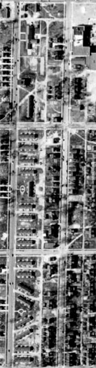 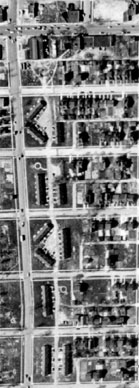 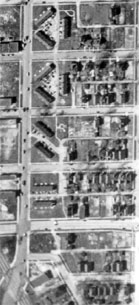 This collection south and east of Hoover & Seven Mile, where Osborn High is now: 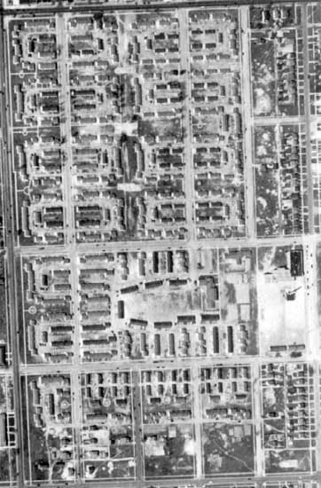 Down by the river, at the foot of St Jean and to the west at Engle Park: 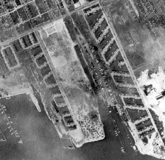 Still looking... | ||
Hornwrecker Member Username: Hornwrecker Post Number: 1204 Registered: 04-2005 Posted From: 63.41.8.160 |
Sorry to have preempted your research Mikem, it was coincidental. Interesting to see that all of Bessey Field was temp housing, something that I've never heard about before. BZ (Navyspeak for well done.) | ||
Mikem Member Username: Mikem Post Number: 2552 Registered: 10-2003 Posted From: 68.43.15.105 |
I'll let you do the west side ; ) | ||
Pffft Member Username: Pffft Post Number: 975 Registered: 12-2003 Posted From: 69.221.95.60 |
Why were there so many projects along Dequindre, do you suppose? Seems as though it was mixed industrial/residential even back then, of course. | ||
Hornwrecker Member Username: Hornwrecker Post Number: 1205 Registered: 04-2005 Posted From: 63.41.8.160 |
You mean, there's a Westside? Who knew? | ||
Mikem Member Username: Mikem Post Number: 2553 Registered: 10-2003 Posted From: 68.43.15.105 |
I'm not sure why Pffft. I'm guessing that the major streets on the outskirts of town were laid out first through former farm land and swamps, then developers came along and filled in the squares with residential streets and homes, leaving the major streets devoid of houses. When the war started and it came time to find space to erect temporary housing, the empty, still undeveloped sides of streets like Dequindre and Mound and Oakland were available. Plus, the boom in war production was causing industry to move outward from the older industrial areas in the city's core. HW, that was a lot of work; I'm Tango Uniform! How's that for sailor talk? | ||
Hornwrecker Member Username: Hornwrecker Post Number: 1206 Registered: 04-2005 Posted From: 63.41.8.160 |
It looks like 3/4 of the housing was adjacent to railroad tracks, which makes sense as that is where heavy industry is located. The rest are still relatively close to them, a short walk or bike ride to them, considering that they had to be put in available space. I sure would like to see systematic aerials from the late 30s for comparison. I got fatigued just looking at that map, M. I don't want to even think about mapping the OCF db. | ||
Pffft Member Username: Pffft Post Number: 976 Registered: 12-2003 Posted From: 69.221.95.60 |
Yeah, I can see why Vlasic would want to locate on that Dequindre location, so close to the train lines. It's funny, the Detroit plant doesn't get mentioned in any of the Vlasic company histories I looked at... | ||
Mikem Member Username: Mikem Post Number: 2576 Registered: 10-2003 Posted From: 68.43.15.105 |
DeLorean's childhood home: 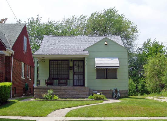 What's left of the Charles Terrace project (about a dozen of these buildings): 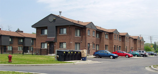 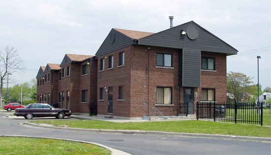 However, most of it is gone: 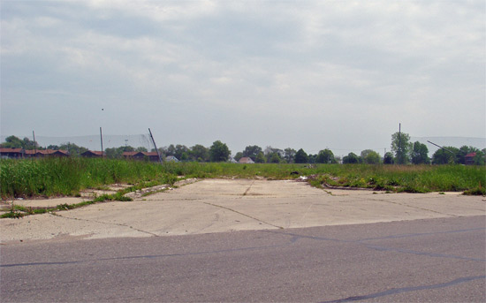 I had wondered if the drives through the complex had their own names. These projects were large enough at the time to have one or more steam heating plants of their own. This sign indicates that Heating Plant #2 was on Buffalo Court. Does the "-6-" indicate this was service drive number 6, or did they have the unusual speed limit of 6 mph through the complex? 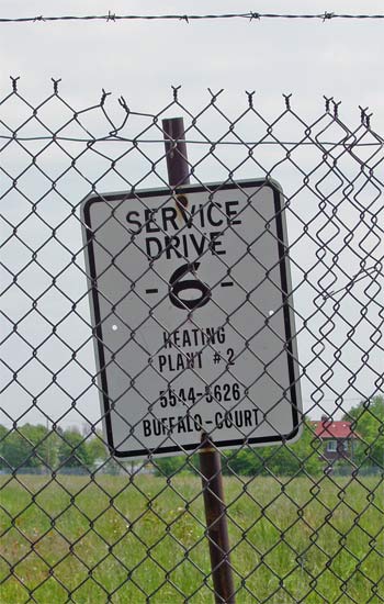 The "1950's housing in the middle of 1920's Detroit" which Hamtramck_Steve mentioned: 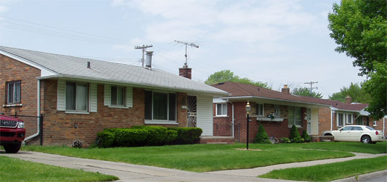 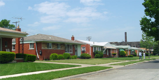 | ||
Mikem Member Username: Mikem Post Number: 2577 Registered: 10-2003 Posted From: 68.43.15.105 |
Oh, and the church building which will occupy the land at 6 & Dequindre: 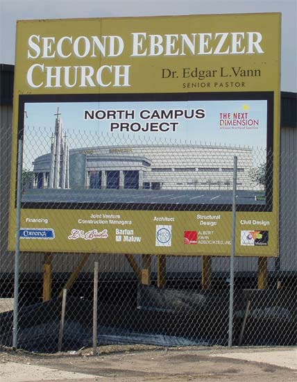 | ||
Livedog2 Member Username: Livedog2 Post Number: 327 Registered: 03-2006 Posted From: 24.223.133.177 |
Awesome, Mikem! You're the only one that always makes sense on this site!! Livedog2 | ||
Pffft Member Username: Pffft Post Number: 994 Registered: 12-2003 Posted From: 71.144.86.59 |
Fantastic, MikeM... You know, I swear I see a lot of larger homes built in the '50s and/or '60s around Detroit. I just was down Evergreen by Fenkell, a block from Rosedale Park, and there were all these Colonials along Evergreen that to my eye were late '50s or early '60s vintage. There's a typical early '60s Colonial (large) I always see on the edge of Palmer Woods as I'm going down Woodward. Maybe these were infill type housing, although there was a block or two of Evergreen where they're almost all like that. So '50s housing doesn't surprise me in Detroit, although the small '50s houses are a bit of a surprise. Those look like south Warren or Hazel Park, more. | ||
Bushay Member Username: Bushay Post Number: 18 Registered: 05-2005 Posted From: 68.61.167.97 |
>It's funny, the Detroit plant doesn't get mentioned in any of the Vlasic company histories I looked at... I was telling my older brother about this thread as he once worked for Vlasic many years ago and he has no recollection of a Vlasic facility on or near 6 mile and Dequindre. I believe he told me the one he worked at was on or near 12 mile and Telegraph or Greenfield. And then moved to West Bloomfield Twp. | ||
Royaloakian Member Username: Royaloakian Post Number: 72 Registered: 05-2004 Posted From: 152.163.100.8 |
the old Vlassic pickle building (plant? main offices? distribution center?) is still on Dequindre. It is now occupied by Caramango Foods at 14522. there is a row of trees out front and behind those trees is the green trim from its Vlassic days as I remember them. The building may have had add ons I don't remember much more than the front. I remember they moved to the suburbs when they left gotta be 30 plus years ago. | ||
Pffft Member Username: Pffft Post Number: 999 Registered: 12-2003 Posted From: 12.34.51.20 |
Thanks ROian...the former project resident I spoke to specifically mentioned the green trim of the building, dating from Vlasic days, still being there. I thought the megachurch being built at Six and Dequindre is on that site now, though? | ||
Mikem Member Username: Mikem Post Number: 2586 Registered: 10-2003 Posted From: 68.43.15.105 |
The church is north of the tracks, north of the kink in Dequindre, where the housing project was. Vlasic is south of the tracks and the housing project. Vlasic didn't replace the project. Whatever was built on the grounds of the housing complex in those old aerial photos was something other than Vlasic. | ||
Pffft Member Username: Pffft Post Number: 1000 Registered: 12-2003 Posted From: 12.34.51.20 |
Ahhhhh....tbanks Mike. |