Mackinaw Member Username: Mackinaw Post Number: 1162 Registered: 02-2005 Posted From: 141.213.173.94 |
We all know that snow would liven up downtown a bit (as if it needs more life right now) and would certainly make Winterblast awesome. Right now it looks like we will continue with more of the same above normal temperatures through Friday, and then it will definitly be cold for Saturday and Sunday. The question is, will the major storm forecast to come out of the Rockies/Plains bring us heavy snow? The forecasters are beginning to deal with the prospect of a storm somewhere in the Saturday-Sunday timeframe. I don't think that even a foot of snow could cripple this Super Bowl, since it is centered downtown and crews can focus all their resources there. But it would be quite a novelty and would add an element to the intense media coverage in the city. We'll use this thread to provide links to different weather resources and keep each other updated on the latest forecast all week. http://www.crh.noaa.gov/dtx/ | ||
Hamtramck_steve Member Username: Hamtramck_steve Post Number: 2675 Registered: 10-2003 Posted From: 69.209.188.186 |
I'll toss in Accuweather. http://wwwa.accuweather.com/fo recast-15day.asp?partner=accuw eather&myadc=0&traveler=1&zipc ode=48226&metric=0 (Message edited by Hamtramck Steve on January 30, 2006) | ||
Gravitymachine Member Username: Gravitymachine Post Number: 801 Registered: 05-2005 Posted From: 198.208.159.18 |
While I can't complain too much since I am in the process of moving, this warm weather is pretty disconcerting... | ||
Mackinaw Member Username: Mackinaw Post Number: 1163 Registered: 02-2005 Posted From: 141.213.173.94 |
It would be disconcerting if it forced the cancellation of certain aspects of Winterblast. With about 4-5 straight warm weeks, we all know that it is bound to change, and with our luck it will happen on Super Weekend. | ||
Boshna Member Username: Boshna Post Number: 118 Registered: 01-2005 Posted From: 141.213.217.188 |
Great thread idea Mackinaw. The snow will not cause problems with the Winterblast at all. Last year I drove 4 friends from Ann Arbor to Winterblast. There was close to a foot of fresh snow on the ground that day. Nothing was cancelled at all and the place was still packed. Trudging down the middle of a snow-covered John R with others heading down to CM was a wonderful wonderful experience. | ||
Lmichigan Member Username: Lmichigan Post Number: 3119 Registered: 10-2003 Posted From: 67.172.95.197 |
Global Waring-atcha!  Seriously, there are always a few off us that decry that the earth is getting warmer every year, but it does seems as if winters are getting milder even since I've been born (20 years). It really sucks, IMO. A winter without snow looks so bad outside. | ||
Hamtramck_steve Member Username: Hamtramck_steve Post Number: 2676 Registered: 10-2003 Posted From: 69.209.188.186 |
Winter's milder here, but it's a record-breaking cold in Europe. Last week, subway tracks cracked in Austria, Germany closed a canal to shipping and a zoo had to bring their PENGUINS inside. I never saw any news reports about what kind of penguins these are, but they are some lame-ass birds. | ||
Clark1mt Member Username: Clark1mt Post Number: 43 Registered: 06-2005 Posted From: 4.229.15.241 |
At present, the most interesting situation setting up for the next week is the (perhaps temporary) return of below-freezing high temps for Saturday and Sunday. This appears to correlate with a system moving through Friday night-Saturday morning. Precip would start as rain and change to snow by late Friday night. Some significant snow could result, but the warmer ground and later transition to snow in Detroit will likely keep any accumulations fairly light (think along the lines of the last expected snow). I don't see anything in the models to suggest any major snow issues on Sunday. The best chance will be if the Sat.-Sun. storm moves further north than it looks to do now. Having said all of that, forecasting beyond 3 days is reliable, but never certain, and going beyond 5 days can be haphazard at best, especially with regard to yet-to-develop systems. Accuweather sucks. | ||
Jasoncw Member Username: Jasoncw Post Number: 105 Registered: 07-2005 Posted From: 148.61.248.29 |
I think the city should buy a few giant fake palm trees and plop them in Campus Martius | ||
Mackinaw Member Username: Mackinaw Post Number: 1164 Registered: 02-2005 Posted From: 141.213.173.94 |
Boshna, like you say, the snow would make Winterblast exponentially cooler. Last year was up north quality. This forecast model is widely used, and at last check looked pretty ominous: http://www.nco.ncep.noaa.gov/p mb/nwprod/analysis/namer/gfs/0 0/index_p24_s_loop.shtml slow the animation down a bit and watch how 1 to 2 inches of moisture plumes right through lower Michigan late Saturday and Sunday. That adds up to tons of possible snow. | ||
Jerome81 Member Username: Jerome81 Post Number: 907 Registered: 11-2003 Posted From: 64.142.86.133 |
www.wunderground.com is my fav. I'm hoping for snow. I was there for Christmas and it SUCKED. I can't believe the warmth. People are probably forgetting what "real" winter is supposed to be. I think snow would make the superbowl uniquely detroit. A good several inches would be perfect. A blizzard like in Pontiac superbowl would probably be bad. | ||
Mackinaw Member Username: Mackinaw Post Number: 1165 Registered: 02-2005 Posted From: 141.213.173.94 |
...an update for tuesday: cold weather looks like a lock for this weekend (hopefully the complaining will be minimized by the not too harsh days now through Friday)...looks like some snow will likely occur, but the forecasts are all over in terms of whether the storm will go along the eastern Appalachians or more towards Ohio/Ontario...this would be the difference between 2 or 12 inches of snow. In other words, let's revive this thread come Thursday or Friday. | ||
Mikem Member Username: Mikem Post Number: 2347 Registered: 10-2003 Posted From: 68.43.15.105 |
The Climate Prediction Center has just issued its latest "Hazards Assessment" showing heavy lake effect snow over our area, but lake effect snow tends to be hit or miss around here, so don't hold your breath: http://www.cpc.ncep.noaa.gov/p roducts/predictions/threats/th reats.gif
| ||
Miss_cleo Member Username: Miss_cleo Post Number: 85 Registered: 05-2005 Posted From: 69.47.85.139 |
This is the worst winter ever and I am supremely upset that we have no snow. THis is Michigan for goodness sake! I am planning on moving farther North, cause the winters here have become to mild and I just dont like it. I WANT snow! Pisses me off, when we get moisture, its in the 40's, when its in the lower 30's there is no moisture to be found...wtf?!? | ||
Gravitymachine Member Username: Gravitymachine Post Number: 806 Registered: 05-2005 Posted From: 198.208.159.18 |
i'm totally with you on that miss_cleo | ||
Mackinaw Member Username: Mackinaw Post Number: 1166 Registered: 02-2005 Posted From: 141.213.173.94 |
Yep. It's gonna be up there with the warmest Januarys of all time. Don't forget though, December (until Christmas) was colder than normal, with nearly twice the normal amount of snow. | ||
Gumby Member Username: Gumby Post Number: 830 Registered: 11-2003 Posted From: 141.216.1.4 |
Why not they already have them in the RenCen? | ||
Islandman Member Username: Islandman Post Number: 53 Registered: 08-2004 Posted From: 68.42.171.59 |
I think you guys are forgetting how friggin cold it was the last 2 winters. I'm enjoying the hell out of this. If my body remembers correctly. there were temps in the 0-10 degree range last year that didn't go away for weeks and everyone was over it. Don't get me wrong, I like snow as much as the next person..but this is OK too. | ||
Miss_cleo Member Username: Miss_cleo Post Number: 86 Registered: 05-2005 Posted From: 69.47.85.139 |
I LOVE the cold and prefer it to summers sweltering heat. ITs only bad if the wind is blowing, then it can get bitter, but cold temps dont bother me. I prefer it to trying to do yard work and such when its 90+ degrees out and you cant walk with out sweating...cold is invigorating and makes you feel alive, heat saps my energy....bring on the cold and snow! | ||
Bongman Member Username: Bongman Post Number: 920 Registered: 12-2003 Posted From: 198.111.56.128 |
The effects of global warming as it relates to our recent warm spell are intriguing, however Russia, Finland and other areas are suffering from their worst Winter in a generation. I'll gladly suffer through this warm spell instead. | ||
Miss_cleo Member Username: Miss_cleo Post Number: 87 Registered: 05-2005 Posted From: 69.47.85.139 |
What I am amazed at is how the snow storms seem to go around the Detroit area. North of us gets snow, South of us gets snow (wtf, arent we in the NOrth?) and we get zip. Watch the weather patterns, when they get near Detroit it always splits, above us and below us........I swear SE MI has put up an invisable bio dome to keep the snow out. (Message edited by miss cleo on February 01, 2006) | ||
Mackinaw Member Username: Mackinaw Post Number: 1170 Registered: 02-2005 Posted From: 141.213.173.94 |
I think the same too, sometimes. I thought the same to during June-July when we went into an awful dry spell and thunderstoms would roll through Ann Arbor/Oakland County and then somehow end up as drizzle on the east side and my lawn went brown! | ||
Jimaz Member Username: Jimaz Post Number: 89 Registered: 12-2005 Posted From: 68.2.191.57 |
In Phoenix they call that the "donut" effect. The theory is there's so much asphalt now that the updraft of hot air from Phoenix has begun to affect the local climate. Not sure how it works. Maybe the hot air "re-evaporates" the rain. | ||
Mackinaw Member Username: Mackinaw Post Number: 1176 Registered: 02-2005 Posted From: 141.213.173.94 |
At this point it looks like it will still get much colder after Friday night, and we should get 2-4 inches of snow Saturday/Saturday. Except for the fact that the Winterblast is starting off with rain, this is pretty ideal. It will make things nice again without too much hassle. http://www.crh.noaa.gov/zones/ MIZ076.php?zo=1&city=Wayne+Cou nty | ||
Naturalsister Member Username: Naturalsister Post Number: 461 Registered: 11-2004 Posted From: 68.42.169.65 |
Heard the forcast for the weekend? Looks like we're going to get some white stuff. Check out Mackinaw's link. later - naturalsister | ||
Mackinaw Member Username: Mackinaw Post Number: 1178 Registered: 02-2005 Posted From: 141.213.173.94 |
Ohhh yeah, they're predicting about 2-3 inches in the A2/Brighton area to 4-6 inches along the waterways (since the storm will be just east of us) at this point. The most snow will be tomorrow afternoon and night, providing us a solid full day of real Michigan winter for the Winterblast. I'm hoping to be down there tomorrow with a camera. | ||
Sharmaal Member Username: Sharmaal Post Number: 680 Registered: 09-2004 Posted From: 136.2.1.103 |
Saturday: A chance of rain and snow before noon, then snow likely. Mostly cloudy, with a temperature falling to around 32 by 5pm. North northeast wind between 6 and 15 mph, with gusts as high as 18 mph. Chance of precipitation is 70%. New snow accumulation of 2 to 4 inches possible. http://www.crh.noaa.gov/ifps/M apClick.php?CityName=Detroit&s tate=MI&site=DTX Wish it came down tonight! But I'll take it as long as it starts coming down early tomorrow! | ||
Mikem Member Username: Mikem Post Number: 2358 Registered: 10-2003 Posted From: 68.43.15.105 |
THIS HAZARDOUS WEATHER OUTLOOK IS FOR SOUTHEAST MICHIGAN. .DAY ONE...TODAY AND TONIGHT NO HAZARDOUS WEATHER IS EXPECTED. .DAYS TWO THROUGH SEVEN...SATURDAY THROUGH THURSDAY ACCUMULATING SNOW IS LIKELY ACROSS SOUTHEAST MICHIGAN SATURDAY AFTERNOON AND SATURDAY NIGHT. BEST ESTIMATES OF ACCUMULATION BASED ON THE LATEST DATA INDICATE 1 TO 3 INCHES FROM THE TRI CITIES DOWN TO CORUNNA...HOWELL...ANN ARBOR AND ADRIAN. ACCUMULATION UP TO 6 INCHES IS POSSIBLE NEAR LAKES HURON AND ERIE...AND AROUND 4 INCHES FOR THE CITY OF DETROIT. THESE TOTALS ARE ESTIMATES FOR THE 24 HOURS ENDING SUNDAY MORNING. THE SNOW IS EXPECTED TO DIMINISH DURING SUNDAY AFTERNOON. A DEVELOPING STORM SYSTEM ACROSS THE GULF COAST STATES WILL TRACK NORTHWARD TOWARD THE EASTERN GREAT LAKES THIS WEEKEND. BASED UPON THE LATEST FORECAST PROJECTIONS...ACCUMULATING SNOWFALL IS ANTICIPATED SATURDAY AFTERNOON AND SATURDAY NIGHT. SNOWFALL AMOUNTS WILL LIKELY INCREASE SHARPLY FROM WEST TO EAST OVER SOUTHEAST MICHIGAN. AT THIS TIME...LOWER ACCUMULATIONS ARE EXPECTED FARTHER WEST THAN THOSE LOCATIONS NEAR LAKES HURON AND ERIE. THERE REMAINS CONSIDERABLE UNCERTAINTY AS TO THE STRENGTH AND TRACK OF THIS SYSTEM. STAY TUNED TO THE LATEST FORECAST FROM YOUR NATIONAL WEATHER SERVICE AND LOCAL MEDIA OUTLETS ON THIS DEVELOPING SITUATION. IN ADDITION TO THE SNOW...WINDS WILL INCREASE QUICKLY LATE SATURDAY AND SATURDAY NIGHT. AS TEMPERATURES DROP INTO THE TWENTIES...WIND CHILLS WILL DROP INTO THE SINGLE DIGITS. IN ADDITION...ANY SNOWFALL WE RECEIVE WILL ALSO BECOME BLOWN AND PERHAPS REDUCE VISIBILITIES. COMPARED TO RECENT WEEKS OF ABOVE NORMAL TEMPERATURES...THE UPCOMING WEEK WILL FEEL MORE LIKE WINTER WITH TEMPERATURES AVERAGING AT OR BELOW NORMAL. A NEW STORM SYSTEM MAY BRING ANOTHER CHANCE OF ACCUMULATING SNOWFALL TOWARD THE END OF NEXT WEEK. | ||
Mackinaw Member Username: Mackinaw Post Number: 1179 Registered: 02-2005 Posted From: 141.213.173.94 |
Time for an update: there's a Winter Storm Watch. http://www.crh.noaa.gov/showsi gwx.php?warnzone=MIZ076&warnco unty=MIC163&local_place1=Melvi ndale&product1=Winter+Storm+Wa tch http://www.crh.noaa.gov/dtx/sn ow_image.php?image=20060205_09 00.png&type=StormTotalSnow Snow + a Super Bowl = media frenzy...especially from our local news sources. | ||
Clark1mt Member Username: Clark1mt Post Number: 50 Registered: 06-2005 Posted From: 4.229.129.130 |
A winter storm watch has now been posted for tomorrow afternoon through late tomorrow night. It's almost eerily similar to 1982, except for less snow and not quite so cold. I guess the snow-removal plan might be tested after all. Text below courtesy of NWS and www.wunderground.com LAPEER-OAKLAND-MACOMB-WASHTENA W-WAYNE-LENAWEE-MONROE- ... Winter Storm Watch in effect from Saturday afternoon through late Saturday night... The National Weather Service in Detroit/Pontiac has issued a Winter Storm Watch... which is in effect from Saturday afternoon through late Saturday night. Precipitation is expected to begin as rain Saturday morning... transitioning to snow through mid- afternoon. Snow will be heavy at times with accumulations of 5 to 8 inches possible by early Sunday morning. The transition to snow will occur last near the Michigan border where accumulations will be closer to the low end of this range. A Winter Storm Watch means there is a potential for significant snow... sleet... and wind that may impact travel. As the system passes east of the area during the evening... winds will increase with gusts to 30 mph... causing snow to blow and drift. This blowing and drifting of snow will cause further restriction to visibility making driving conditions increasingly difficult. Persons within the watch area should plan to avoid driving Saturday afternoon and night. Changes in the track of this storm may cause the location of the highest snow accumulation to change. Please continue to monitor the latest forecasts for details about this approaching winter storm. | ||
Sharmaal Member Username: Sharmaal Post Number: 682 Registered: 09-2004 Posted From: 136.2.1.103 |
That's why I'm hoping it's early Saturday. Gives people time to enjoy it during the day, and still isn't coming down on Sunday for the circus. WILL INCREASE THROUGH THE AFTERNOON WITH GUSTS BETWEEN 20 AND 30 MPH CAUSING BLOWING AND DRIFTING OF SNOW OVERNIGHT. That doesn't sound good for tents. | ||
Mackinaw Member Username: Mackinaw Post Number: 1180 Registered: 02-2005 Posted From: 141.213.173.94 |
Sounds like the accumulating snow will be between 3pm saturday and sunrise Sunday. So we'll have a wintry time for primetime Saturday events at Winterfest, and ample cleanup time by Sunday PM. Minus the strong wind, this is pretty okay...actually, awesome. | ||
Caseyc Member Username: Caseyc Post Number: 578 Registered: 11-2003 Posted From: 206.18.111.5 |
THIS IS A GOOD THING. just keep repeating that mantra. It's February in detroit. Do you really want rain? My experience is that a nice snow dump in the 2 to 4 inch range makes everyone more festive...sure it snarls things up a bit more, but it also beautifies, to be sure. It is like a protective winter blanket that drops over the city....from my experience, snowy nights in detroit always had a bit of a festive kick to them..at least for a few days until it turns to black snow along roads and freeways and your car is coated with an inpenetrable coating of saline solution and grime...which isn't quite so attractive. In any event, the tourists and out of towners that everyone is striving so hard to impress will be long gone before the snow starts to turn ugly. | ||
Hamtramck_steve Member Username: Hamtramck_steve Post Number: 2706 Registered: 10-2003 Posted From: 69.208.127.211 |
Today's update! Snow Will Be Heavy At Times Tonight And Then Taper Off Sunday Morning. Total Snow Accumulation From Noon Today Through Noon Sunday Will Be Up To 6 Inches Around The Tri Cities... About 8 Inches Around Detroit... And Up To 12 Inches Near Lake Huron In The Thumb. Strong Winds Will Cause Considerable Blowing And Drifting. | ||
Blessyouboys Member Username: Blessyouboys Post Number: 269 Registered: 07-2005 Posted From: 69.208.126.219 |
Better than this Rain. This is getting ridiculous. | ||
Miss_cleo Member Username: Miss_cleo Post Number: 89 Registered: 05-2005 Posted From: 69.47.85.139 |
As much as I LOVE and WANT snow, I will believe it when I see it. Too many times in the past years snow storms have been hyped to death by the weather people, only to turn out to be a dusting. I hope this time they are right and we get blasted! | ||
Woodward Member Username: Woodward Post Number: 2 Registered: 01-2006 Posted From: 207.91.250.131 |
From New York Times today... Weather Is Great, if Not Timing By JOHN BRANCH DETROIT, Feb. 3 — It is too warm here. The snowshoers have no snow, and the mushers have no slush. There are weight restrictions on the man-made tubing hill, to help keep what is left of the artificial snow from getting pushed to the bottom and melting in the street. "We're only letting the kids on because they're really light," said Joseph Corbo Courtemanche, one of the men who designed and built the popular 28-foot-tall, 285-foot-long Snow Slide downtown. "The snow isn't melting. It's just really soft. It's like cream cheese." In nearly six years of planning for Super Bowl XL, these are the things no one considered: What if it is too warm? What if the only snow is artificial, and even that is melting into cream cheese? All the fears that Super Bowl XL and its surrounding festivities would be buried by real snow and unbearable cold have been melted away with unseasonably warm temperatures or washed away by occasional rain. "It certainly is not what we expected or prepared for," said Susan Sherer, the executive director of the Detroit Super Bowl XL Host Committee. "We really did put a lot of wheels in motion to prepare us for snow and for cold weather, and that's equipment and resources and people and snow shovelers." The only other time the Super Bowl was held in Detroit, in 1982, the city was hit with snow and ice storms. On the day of the game, held indoors at the Pontiac Silverdome, the temperature was 12 degrees; the wind-chill effect made it feel like minus 27. That was the major reason it took 24 years for the game to return, with only one other Super Bowl at a cold-weather site in between — Minneapolis in 1992. Organizers did not imagine a week of temperatures well into the 40's, sometimes not even dipping to freezing at night. "I could have never imagined I'd be talking about the bad side of warm weather," Sherer said. Much of her committee's budget and planning was devoted to combating the one thing they could not control. All they knew was that the average high temperature in early February here is 33 degrees, the average low 20, and that snow is to be expected. So a subcommittee was devoted to snow removal. About 200 student-athletes from Wayne State University were given training, uniforms and a pep rally. In deciding how many parking spots were needed, organizers added 20 percent, assuming some along the edges would be covered in piles of snow. To put their best face on the likelihood of nasty weather, organizers embraced the elements. The Motown Winter Blast, an outdoor festival that began Thursday and is expected to attract 250,000 downtown over its four days, was designed for the cold, aimed at turning gritty city streets into a Rockwellian scene worthy of a snow globe. It was a huge success last year, in what amounted to a trial run for this year, attracting 200,000 people on a weekend of subfreezing temperatures and plenty of snow — real and artificial. "We had snow forever — everywhere," Corbo Courtemanche said. This year, he and Martin Gemme, the owner of a Montreal-based snow-making company, had six snowmaking guns to create at least 70,000 cubic feet of snow for the tubing hill and to cover a blocklong median for sled-dog racing and snowshoeing demonstrations. But it was all they could do to make the hill, which ended up having three lanes instead of the four they planned. The temperatures and the humidity were too high to make more snow. The machines work best when it is about 25 degrees, which it had not been all week. "We can usually bring snow from parking lots and use that to help build a base," said Corbo Courtemanche, who does most of his work farther north. "But even then, there is usually sodium in it from the street, which makes the snow melt a little. Plus, here, there is no snow in the parking lots." Without snow on the median, Bob Anderson, owner of Gee-Packs Sled Dog Team, parked his light wooden sleds with plastic runners and brought out heavy three-wheeled ones with rubber tires. The wheeled sleds are not as nimble, so he ran them with three or four dogs instead of the usual seven. And he could not run the furry dogs for as long each time, because — like snowmaking machines — they prefer temperatures below freezing. "The weather is great for people," Anderson said as his dogs rested on the pavement. "But not so great for the dogs." After it rained Wednesday night, the grass turned slick, causing a couple of dog-sled wipeouts. Then it turned to mud, and event organizers asked Anderson to keep the dogs leashed. Instead of watching dogs run, people stood in line to pet them. The median was shared by REI, the outdoor-equipment retailer, which was letting people snowshoe, but they were marching around on the grass instead. "We tell them, now, when it snows, you'll be ready to go," said Matt Poppleton, a special events administrator for REI. The weather turned colder Friday afternoon, and the forecast for Sunday is more seasonal: a high of 33 degrees, with a good chance of snow. By then, it will be too late. As the evening crowd converged on downtown, Gemme and some workers loaded up the snowmaking equipment, headed back to Montreal and another festival. Just then, it started to rain. | ||
Mikem Member Username: Mikem Post Number: 2359 Registered: 10-2003 Posted From: 68.43.15.105 |
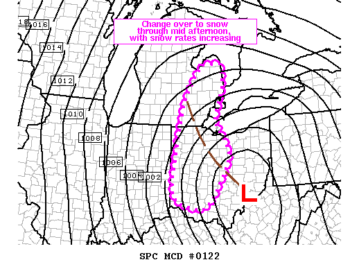 http://www.spc.noaa.gov/products/md/md0122.html | ||
Mikem Member Username: Mikem Post Number: 2362 Registered: 10-2003 Posted From: 68.43.15.105 |
The snow has just started on the eastside. | ||
Woodward Member Username: Woodward Post Number: 3 Registered: 01-2006 Posted From: 207.91.250.131 |
Finally- rain just turned to snow at 2:00! | ||
Mackinaw Member Username: Mackinaw Post Number: 1182 Registered: 02-2005 Posted From: 68.248.7.1 |
And it's coming down now! I was in Campus Martius as the snow started flying and it was a very interesting moment. Should be a fun night at Winterblast...hope they reopen the slide soon. | ||
Miss_cleo Member Username: Miss_cleo Post Number: 91 Registered: 05-2005 Posted From: 69.47.85.139 |
Ha! Wrong again Detroit weather people! I got 2 inches, wheres the 6 you promised me? I knew it was too good to be true | ||
Publicmsu Member Username: Publicmsu Post Number: 590 Registered: 11-2003 Posted From: 71.65.11.17 |
miss cleo should have seen that coming. :| | ||
Mackinaw Member Username: Mackinaw Post Number: 1183 Registered: 02-2005 Posted From: 69.221.65.215 |
No kidding. The warmth of January held on for too long during that storm. I'm sure old man winter will get you back for those 4 inches eventually, probably more of a sneak attack, too. |